Carlsbad Caverns National Park – April 11-16, 2023 – Day 3 – Going Down, Down, Down

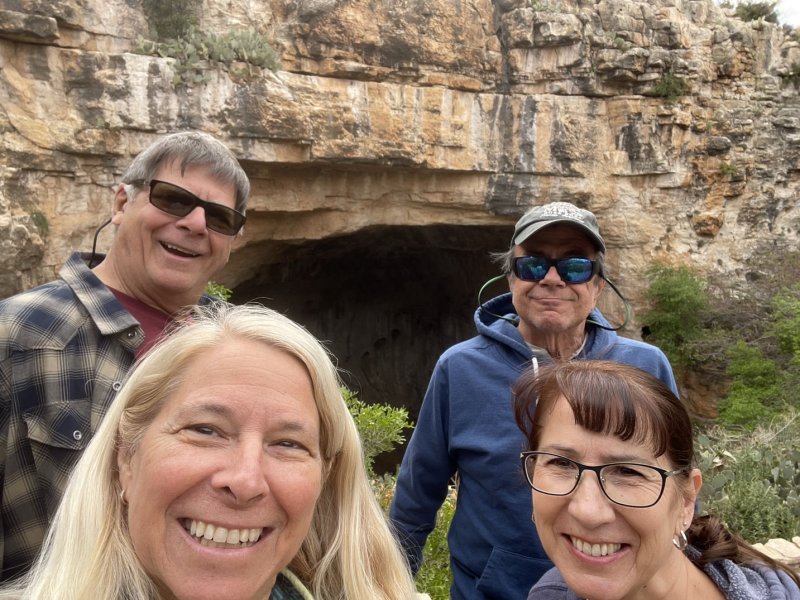
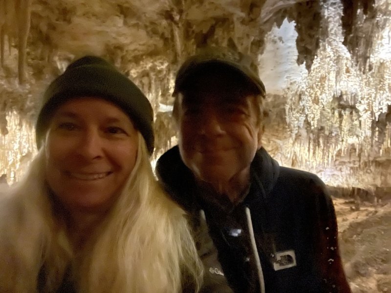
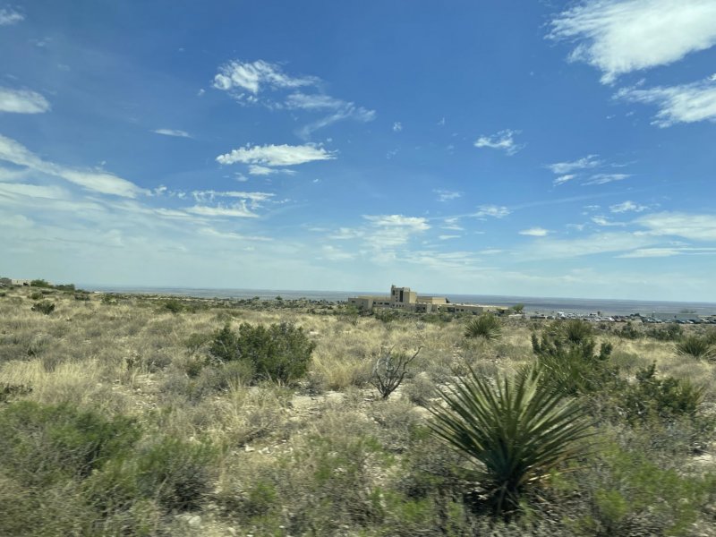
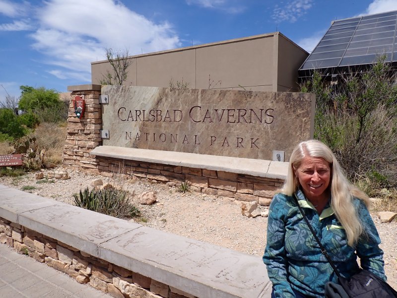
An early meetup with Joy and Larry and drive up the 7-mile road to the park headquarters to begin our visit. Day 3 was a two-event day with a morning hike and exploration down into the caverns and later in the day, a ranger guided tour into the Kings Palace and an elevator ride out.

The following description of the geology of the caverns is extracted from a USGS description of the park.

The area where Carlsbad Caverns is located today was the coastline of an inland sea 250 million years ago. Due to the warm, shallow, tropical seas, the reef formed from mostly sponges and algae instead of coral, like many reefs today. Landward of the reef redbeds, evaporites, lagoonal mudstones, pisolitic grainstones (calcium carbonite grains that build on each other looking like tiny onions), and back-reef grainstones were deposited during this time period. Today, the reef deposit makes up the Capitan Limestone formation, which is 750 feet thick, and most of the National Park is within this limestone formation. Eventually, by the end of the Permian (approximately 251.9 million years ago marked by the largest mass extinction of life in earth’s history), the sea dried up and the reef became buried by sediment for tens/hundreds of millions of years. Fossils from this time period can be seen within Carlsbad Caverns, including ammonites, crinoids, snails, nautiloids, bivalves, brachiopods, and trilobites. 

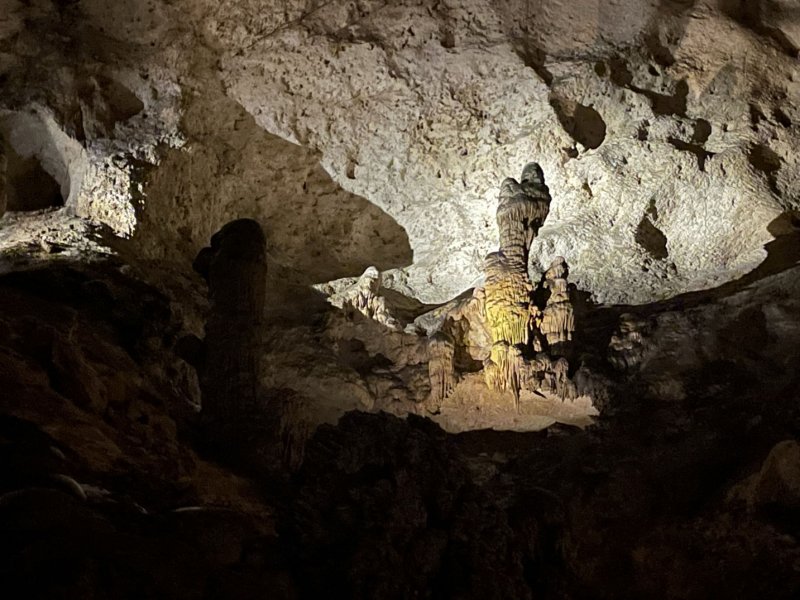
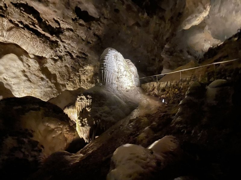
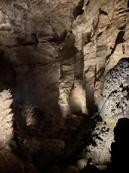
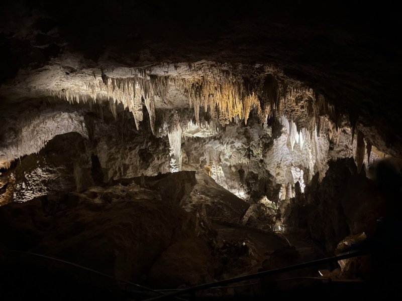
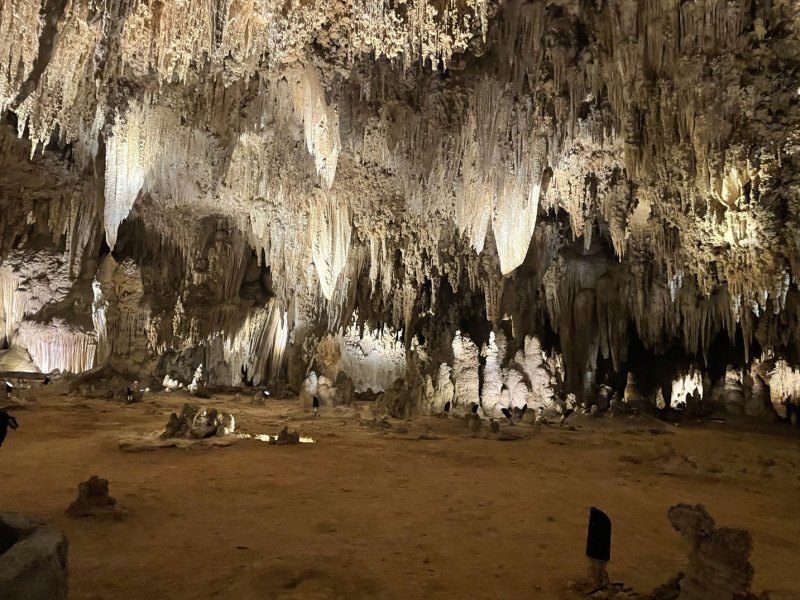
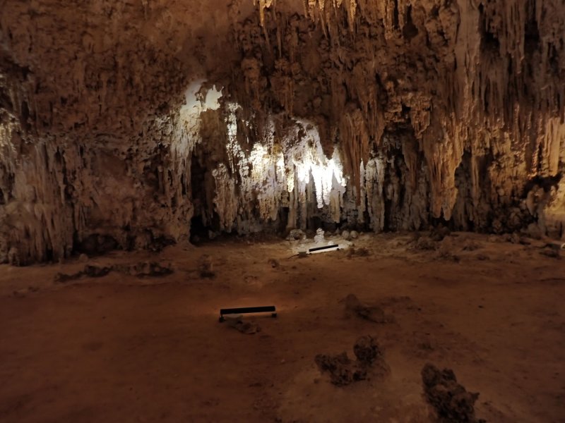
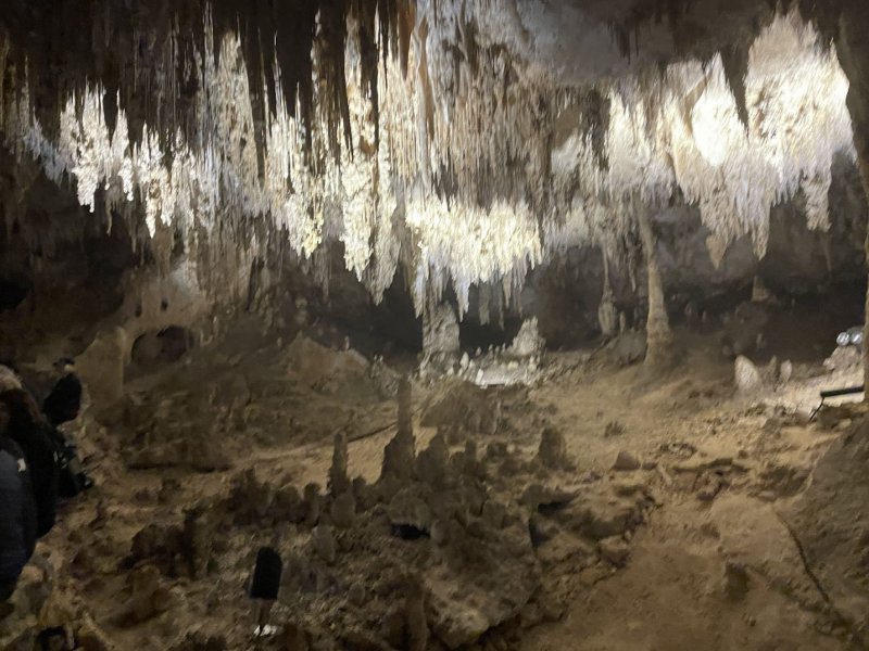
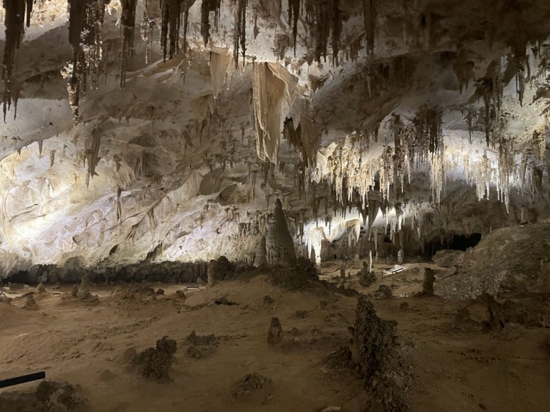
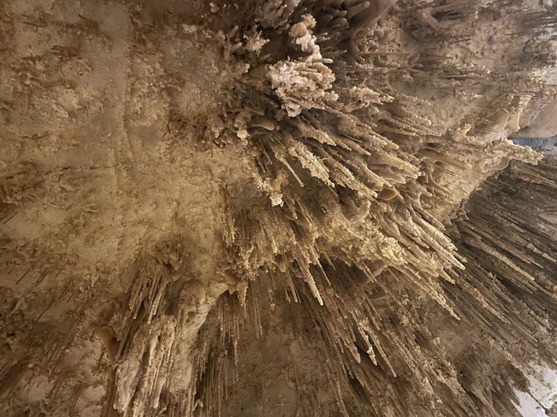
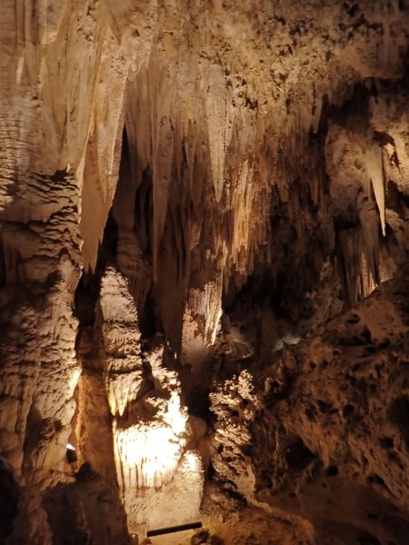
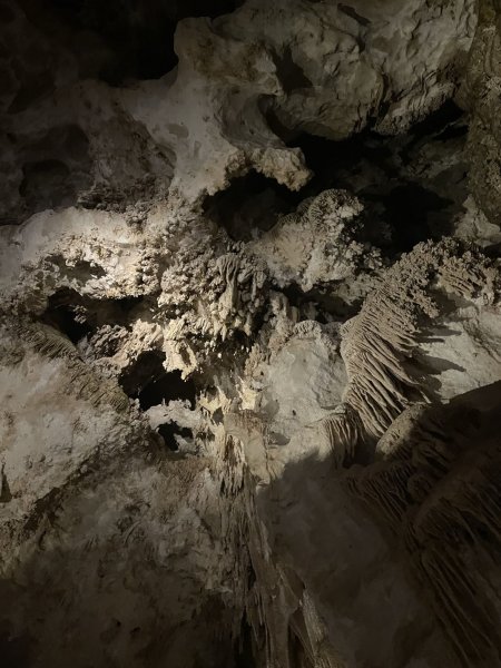
Over the past 20 million years local faulting and stresses of the Earth’s crust uplifted the reef sediment by nearly 10,000 feet, creating the Guadalupe Mountains to the south southwest. The sediment eroded, exposing the reef. Within the Guadalupe Mountains there are more than 300 caves, and 119 known caves within Carlsbad Caverns National Park. The Big Room in Carlsbad Caverns is the largest cave chamber in North America, with 8.2 acres of floor area. Additionally, Lechuguilla Cave is the deepest and third-longest cave in the United States.

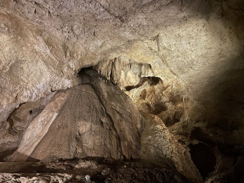
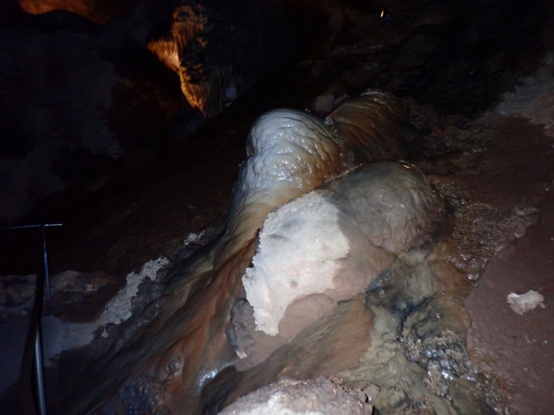
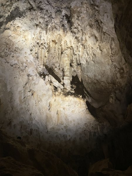
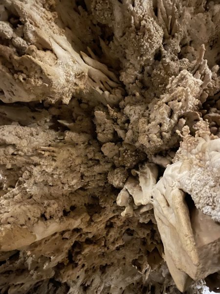
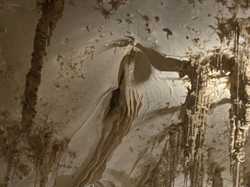
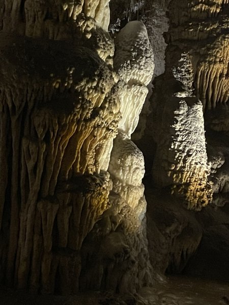
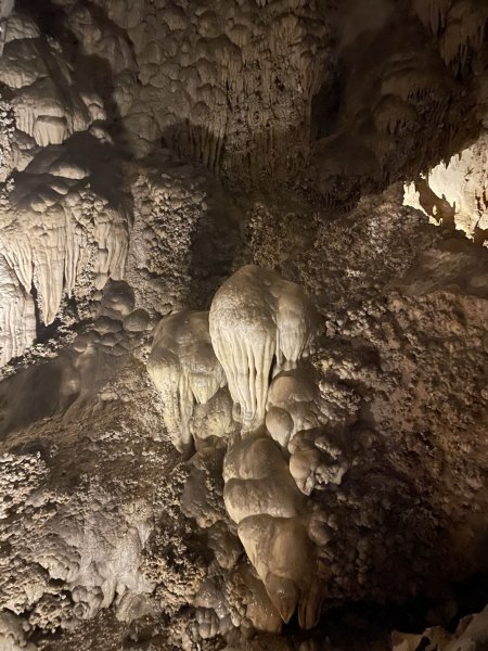
The caves in Carlsbad Caverns are unusual, as they formed from sulfuric acid instead of carbonic acid. Most caves in the world are formed when water interacts with carbon dioxide and seeps downwards. The location of the Guadalupe Mountains played a key role in the creation of these caves. Carlsbad Caverns National Park is located near the border of New Mexico and Texas, and close to the Permian Basin, which hosts large oil fields. Hydrogen sulfide-rich water rose from the oil reservoirs as late as 12 million years ago and mixed with groundwater to form sulfuric acid. The limestone was dissolved at the water table, and therefore, Carlsbad Caverns was dissolved from below and not from above. Gypsum blocks, a byproduct of sulfuric acid dissolution, can be seen today on the floor of the Big Room of the Carlsbad Caverns.

So, there you have it. More interesting to me was the concept that at some point in time each level of the caverns represented a relatively stable water table. As the caverns were formed, and the uplift of the area continued, there was beyond a significant amount of free-standing water in the caves. All those years when the water dousing guys came around looking for the underground rivers and lakes to drill into for water supply had some bit of rationale. If only there had been a limestone bed in the area!!

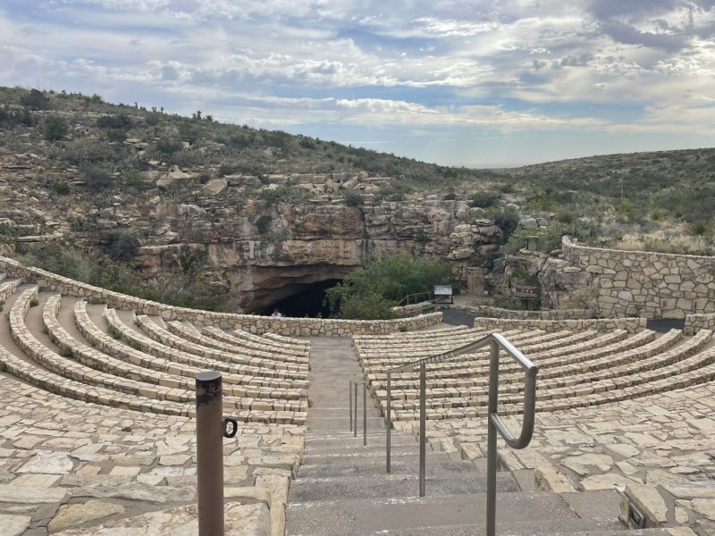
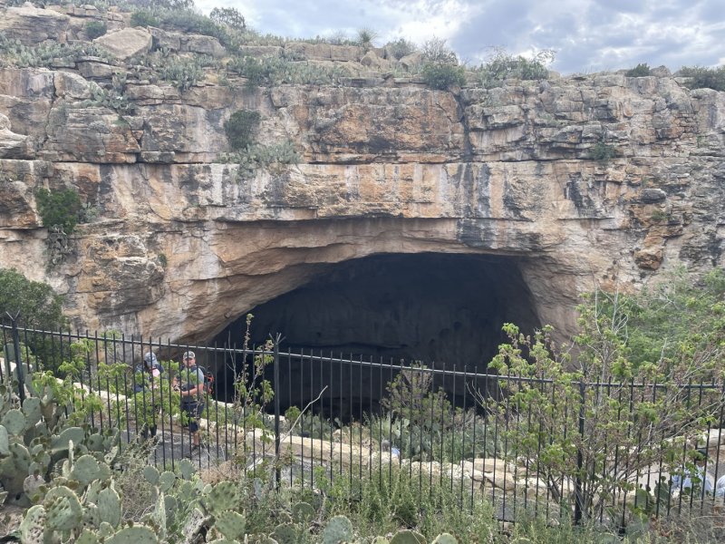
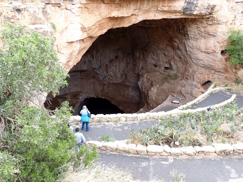
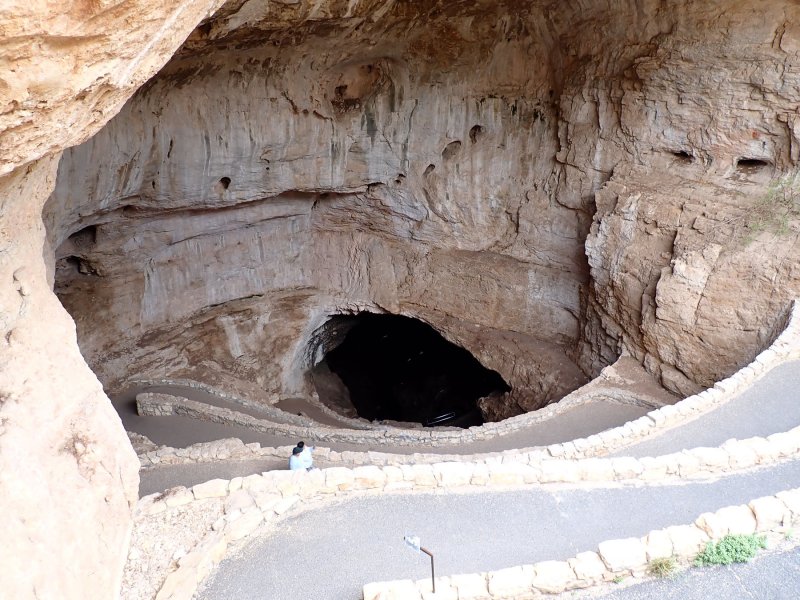
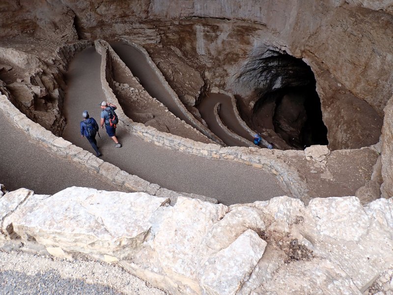
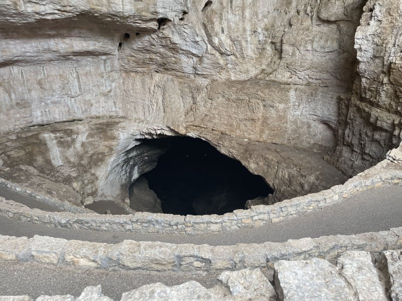
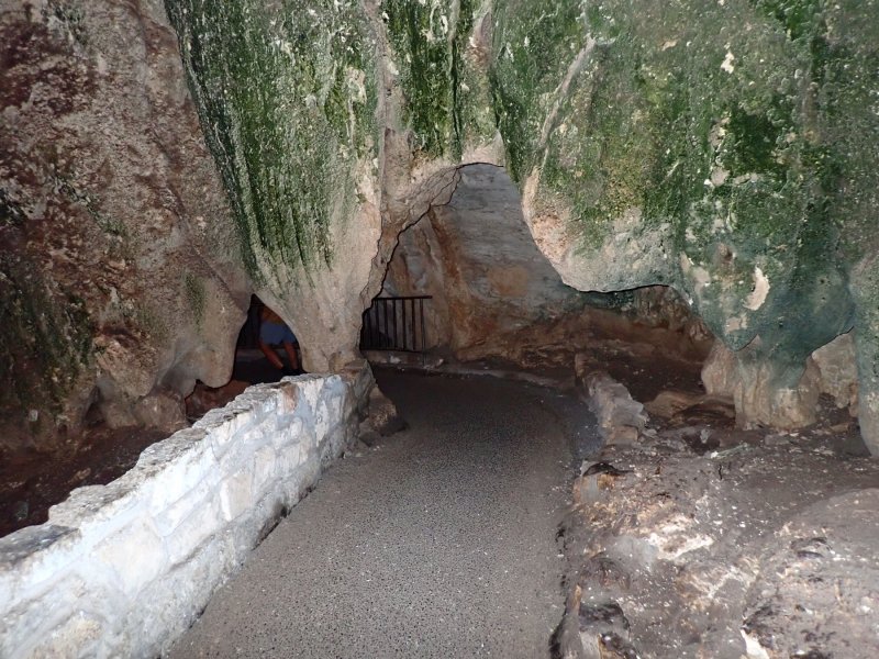
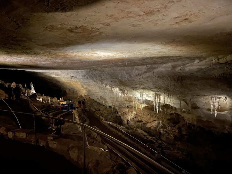
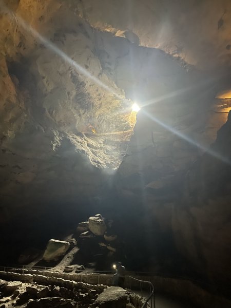
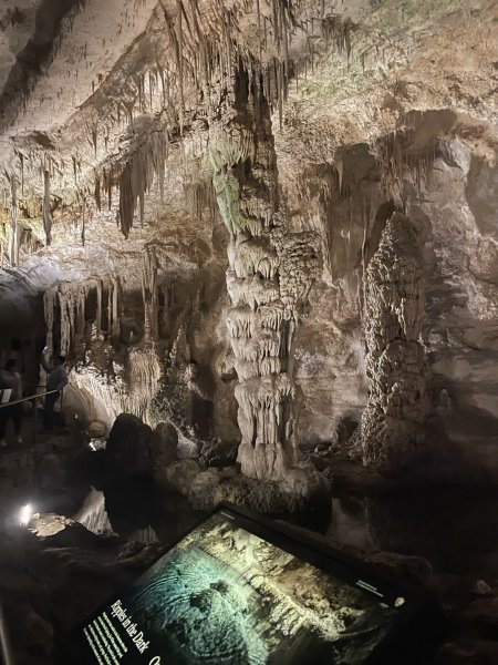
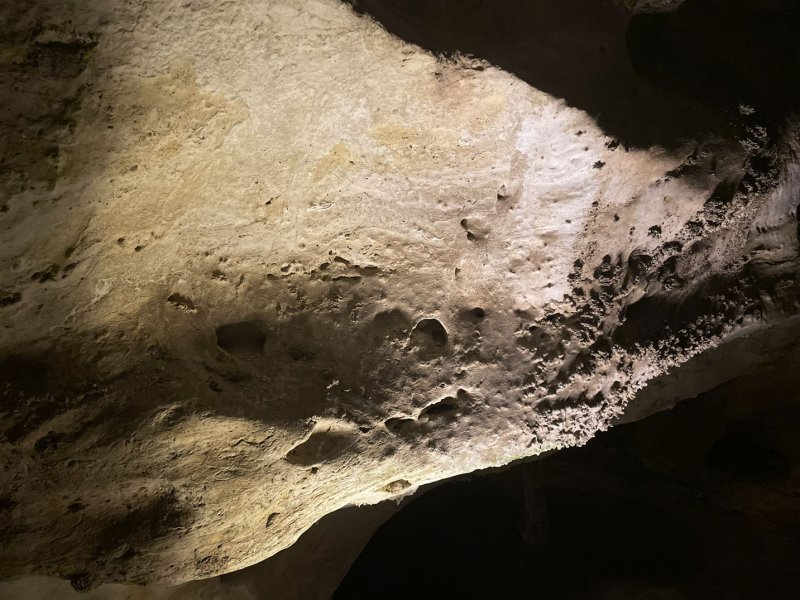
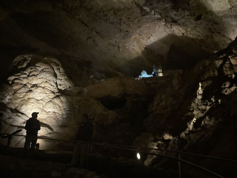
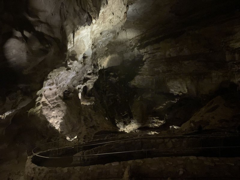
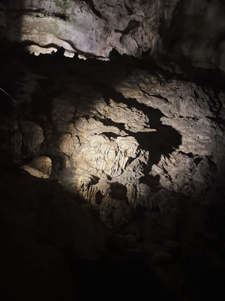
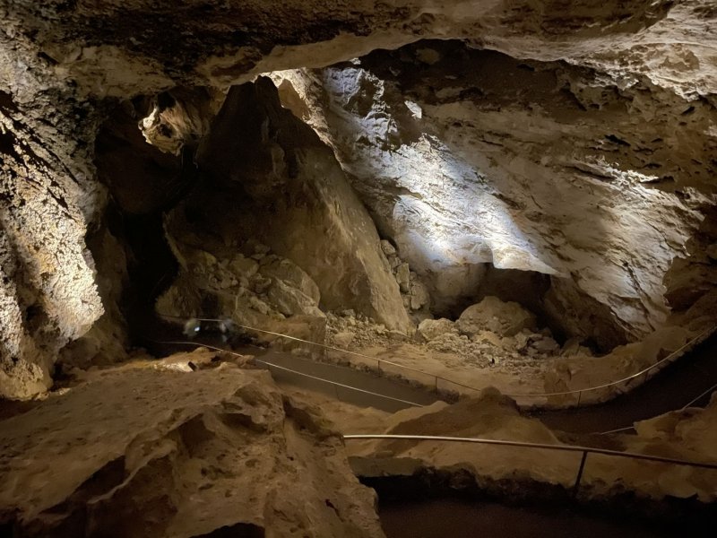
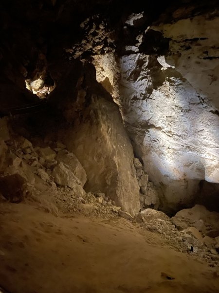
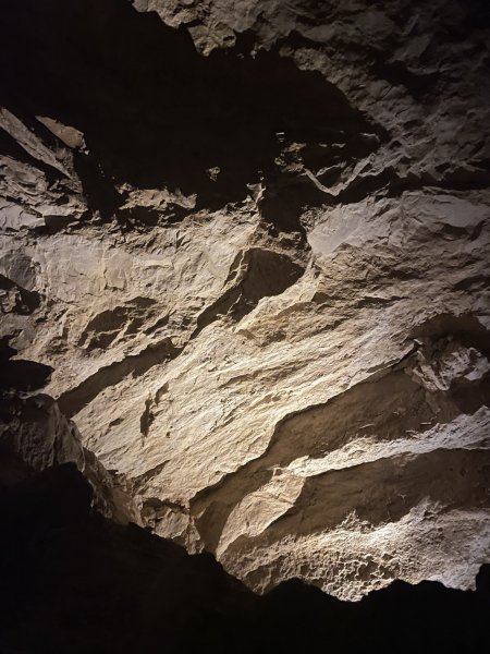
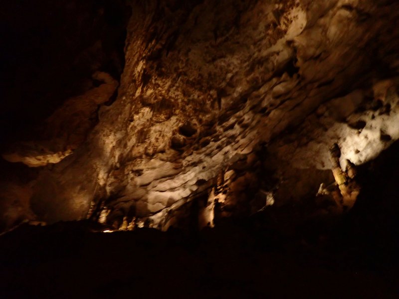
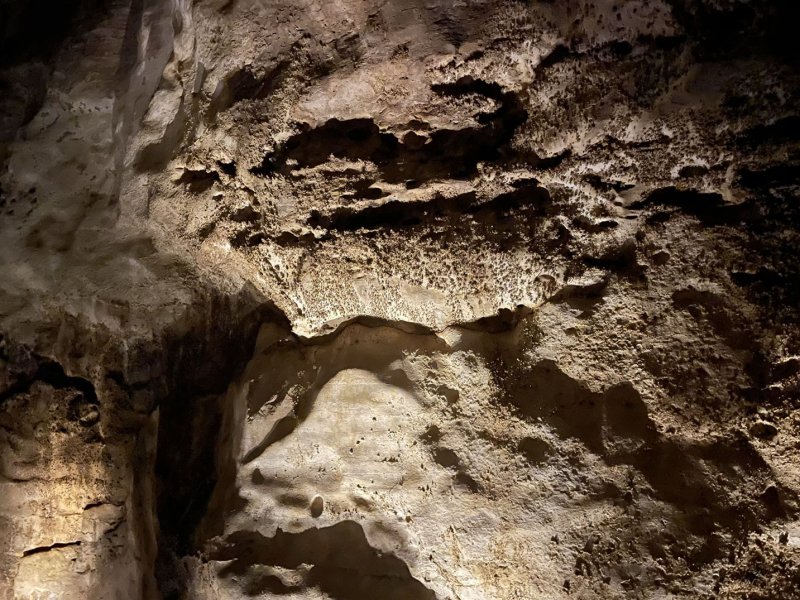
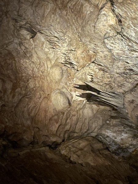
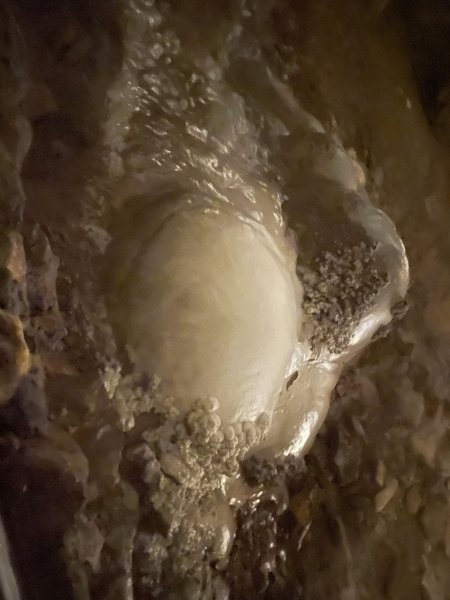
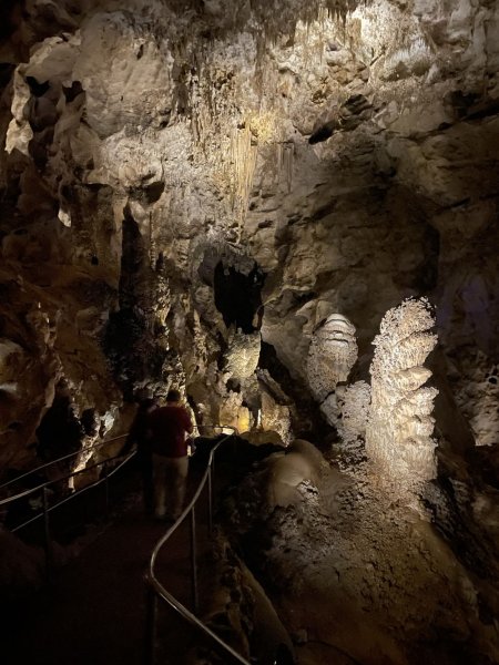
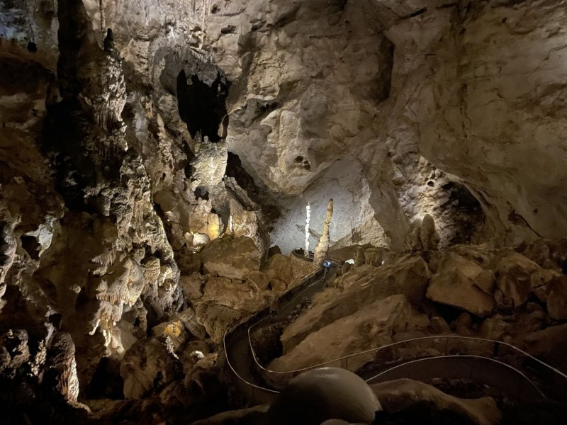
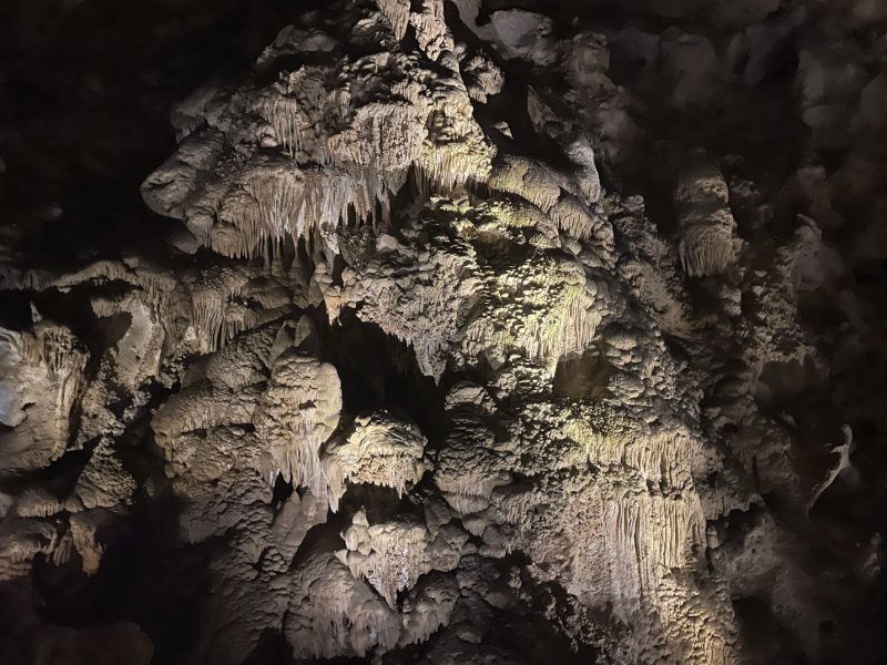
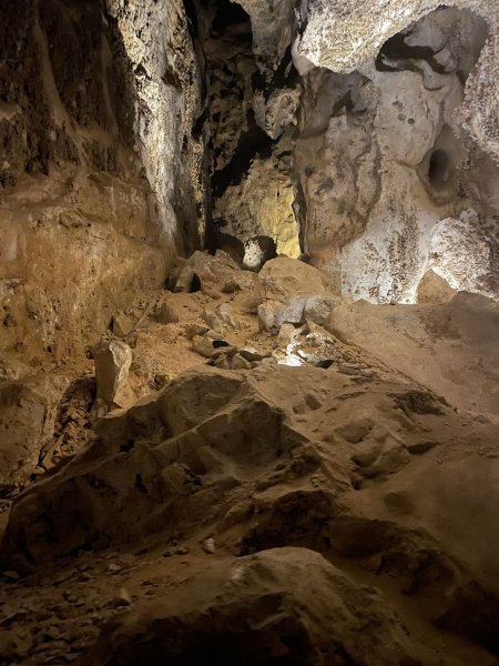
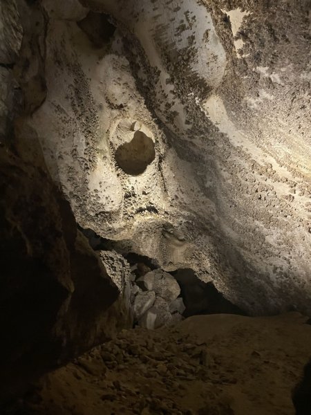
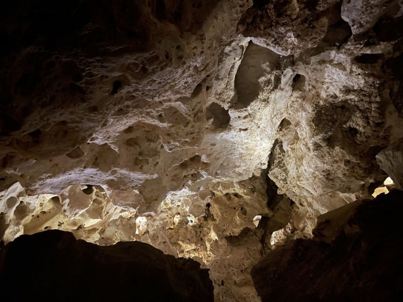
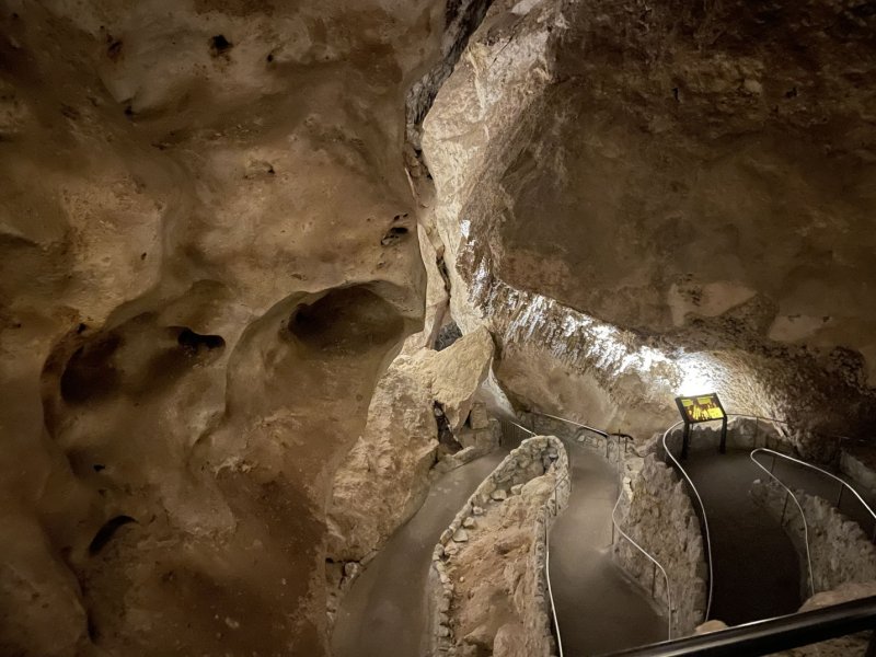
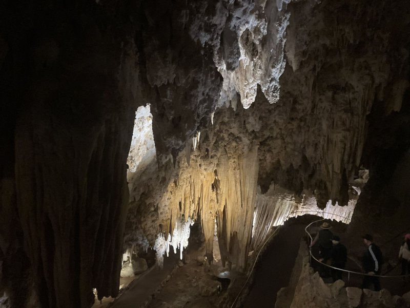
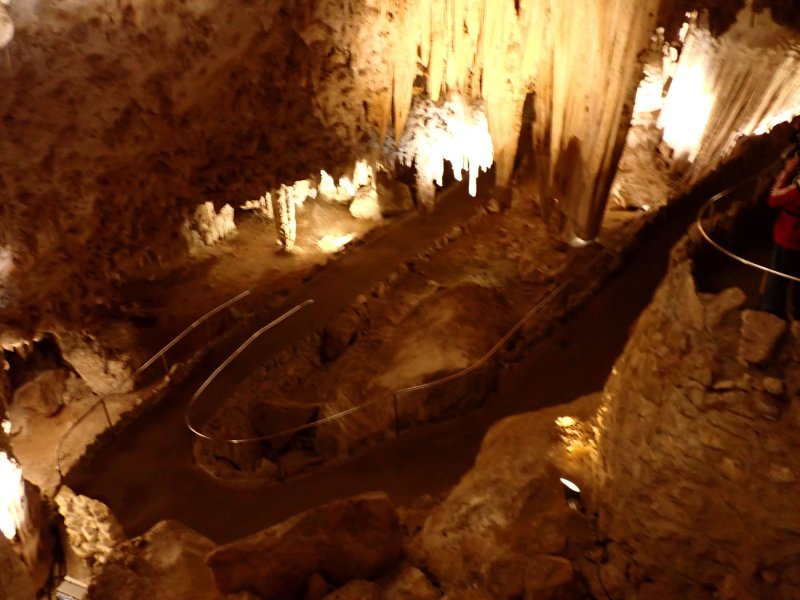
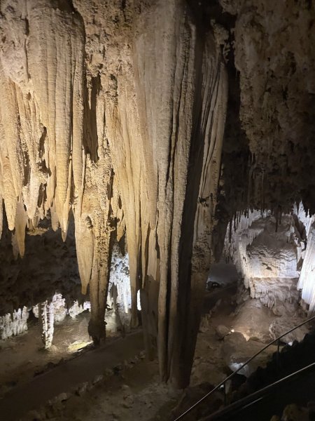
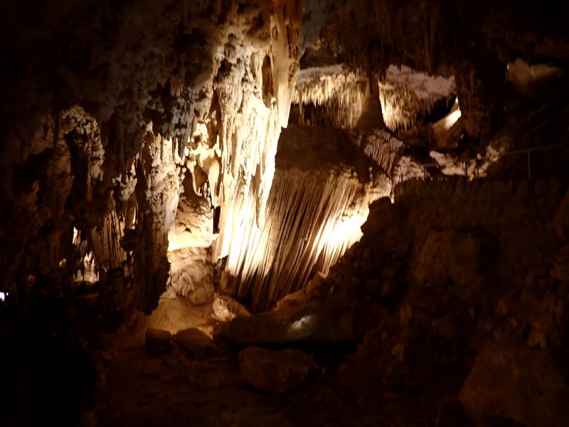
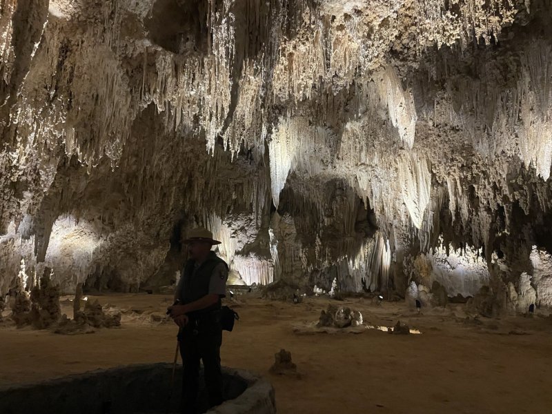
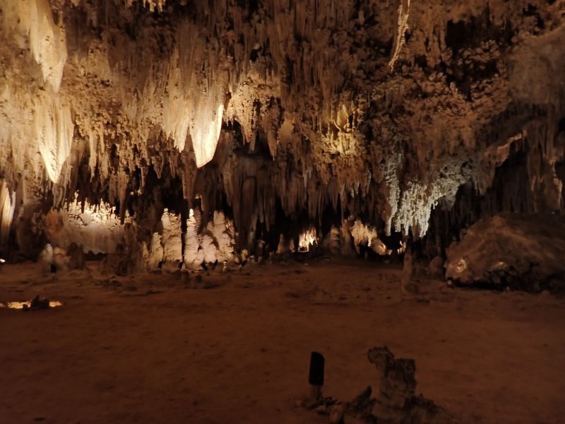
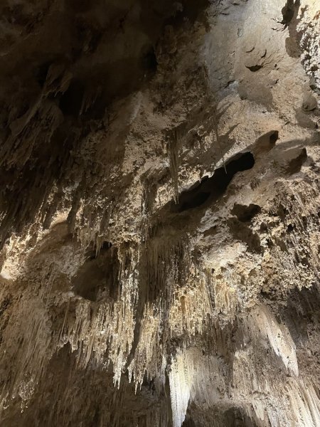
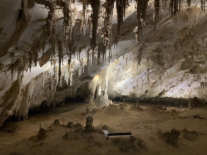
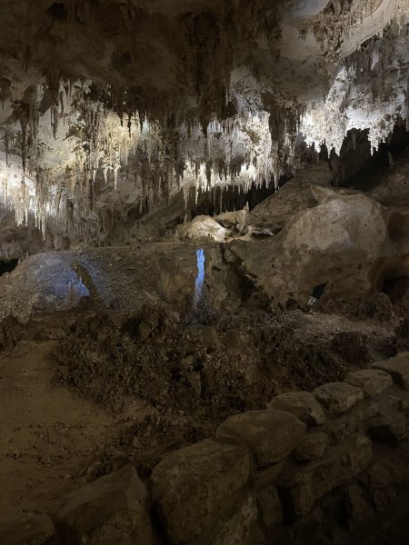
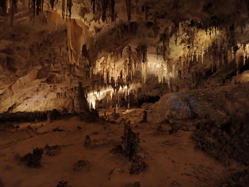
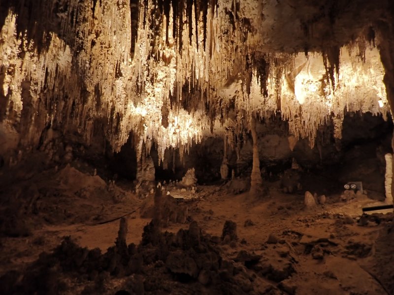
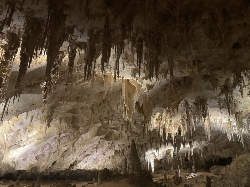
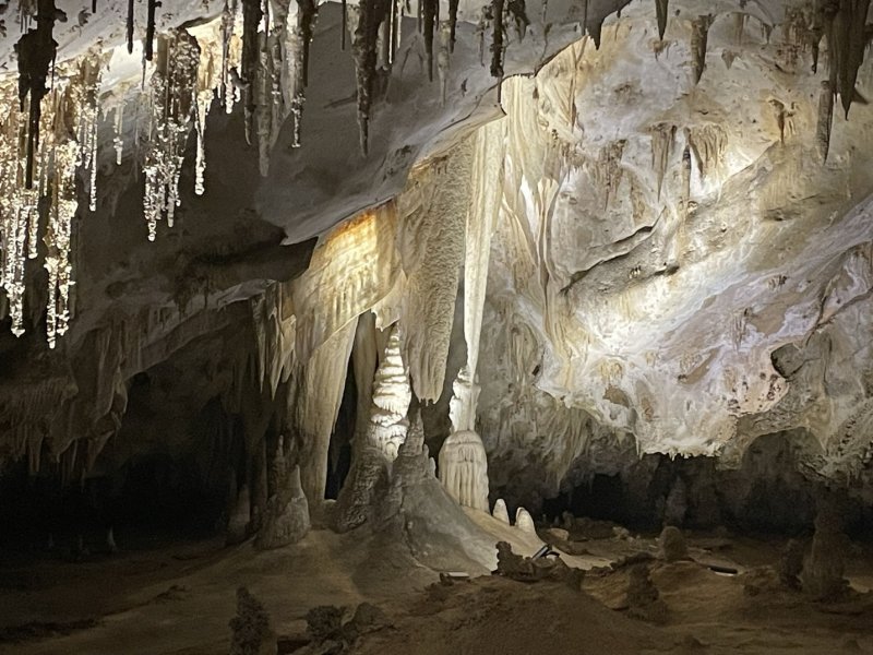
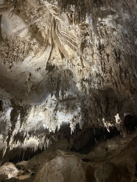
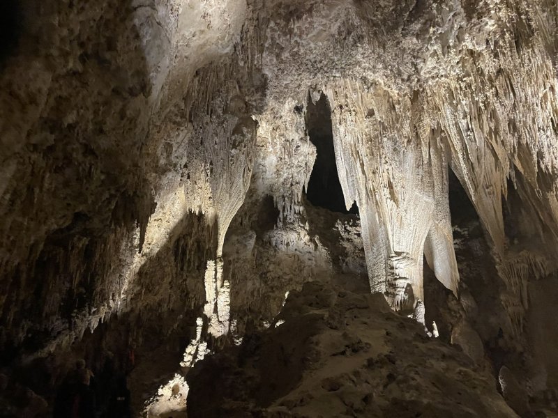
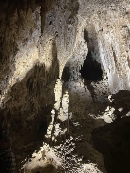
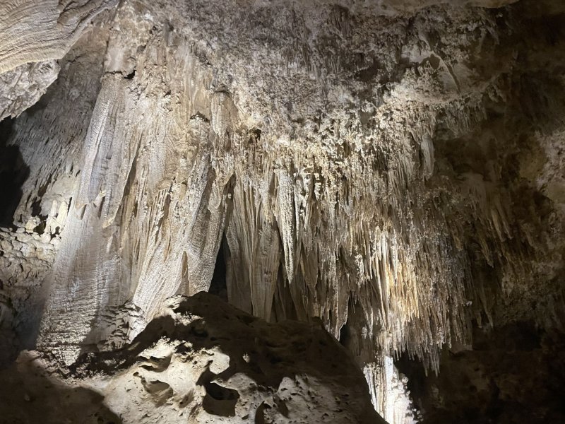
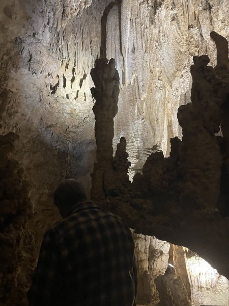
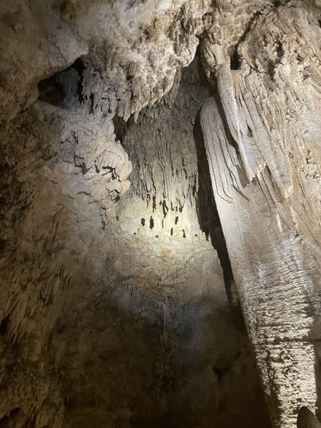
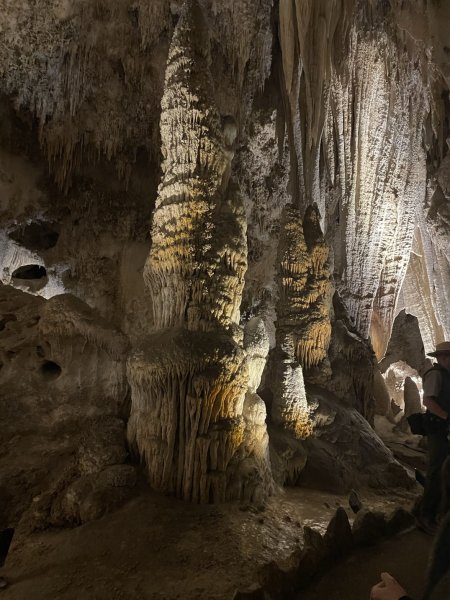
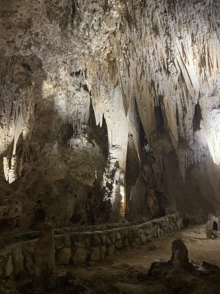
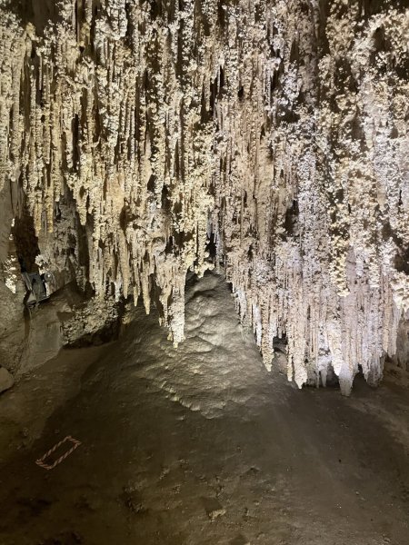
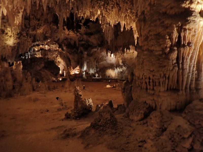
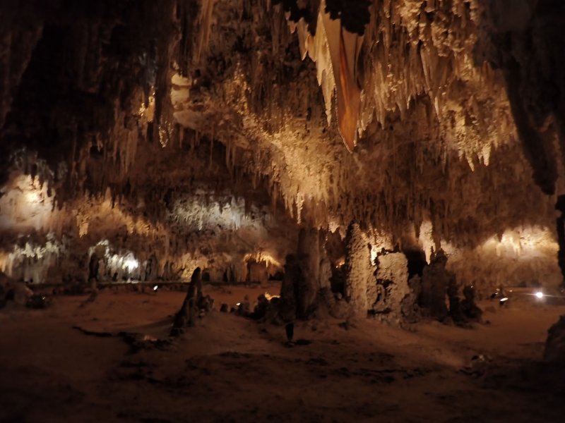
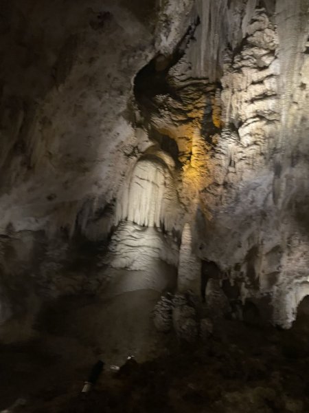
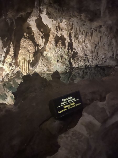
The park was not crowded at all during our visit. After going through the visitor center, we hiked down through the natural entrance to the cave and dropped 750 feet on a 1.25 mile relatively steep switchback trail. As we dropped down the temperature dropped to a chilly 56 degrees F, all light was provided by artificial means, and it got very quiet. Lots to see and appreciate.

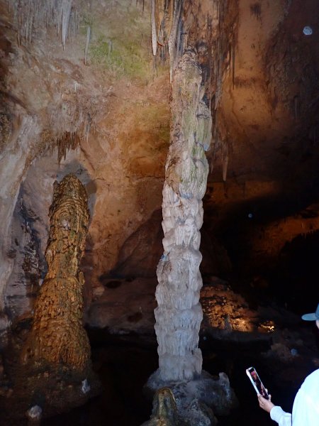
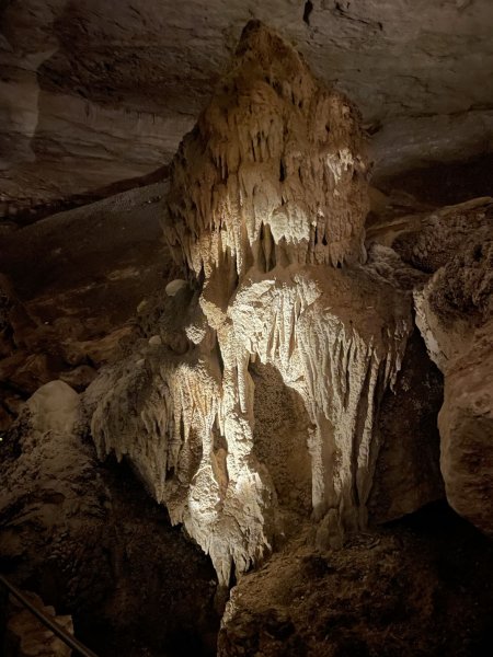
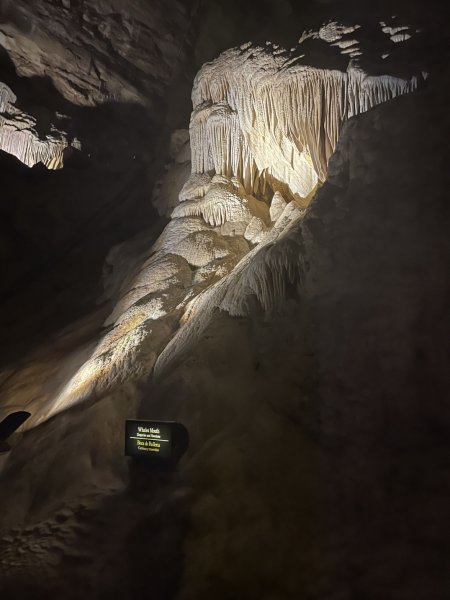
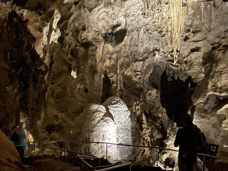
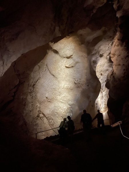
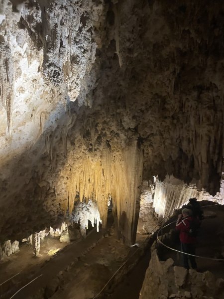
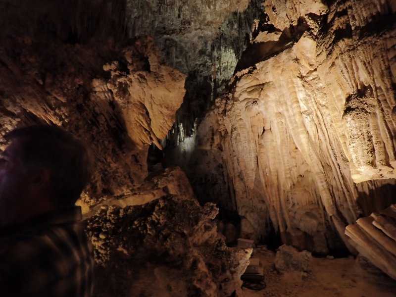
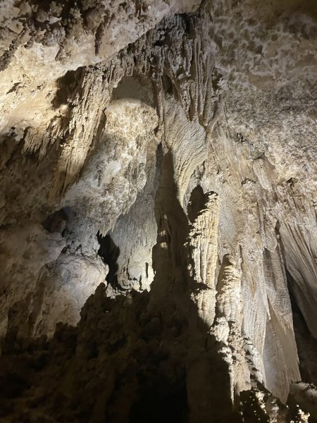
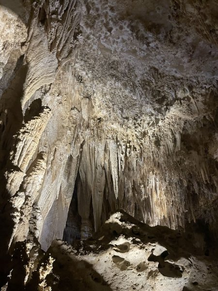
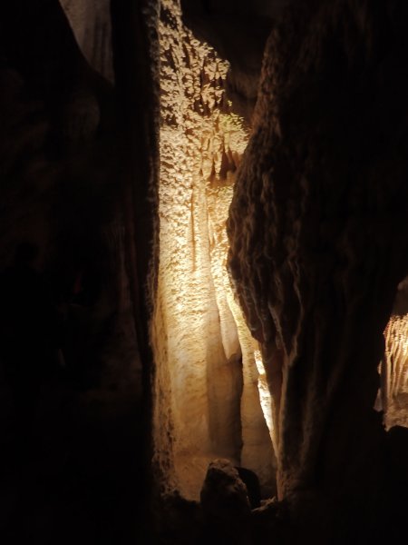
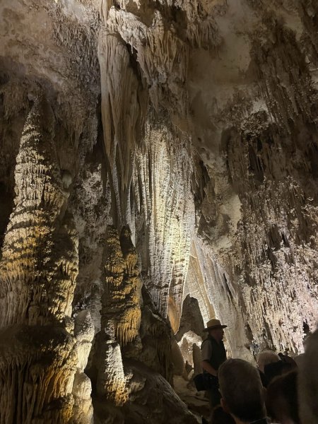
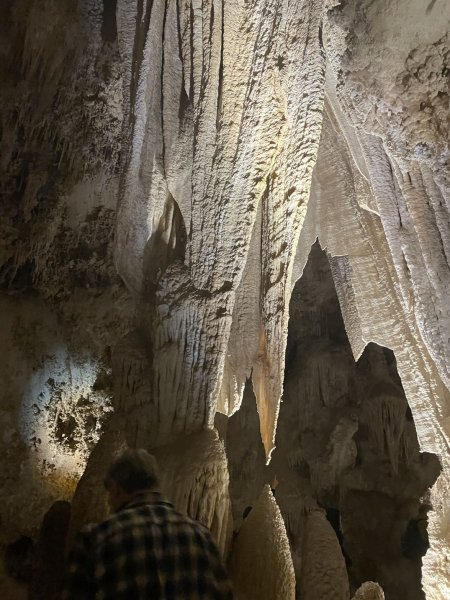
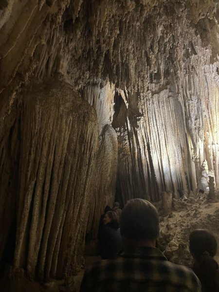
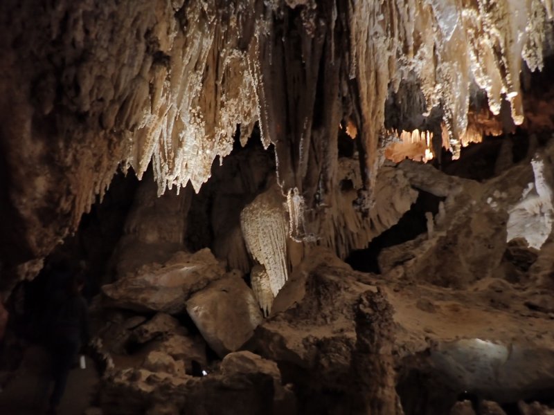
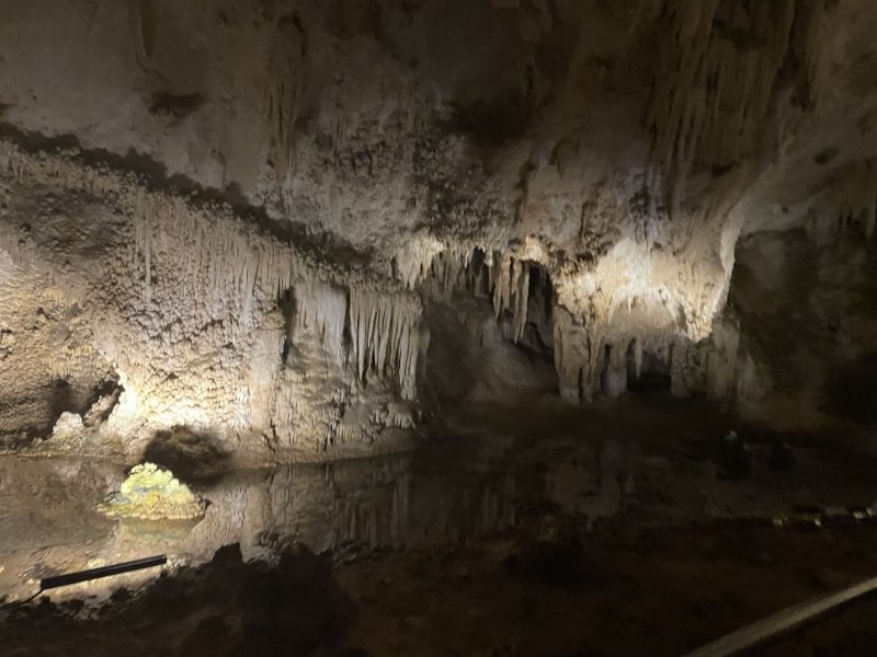
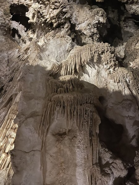
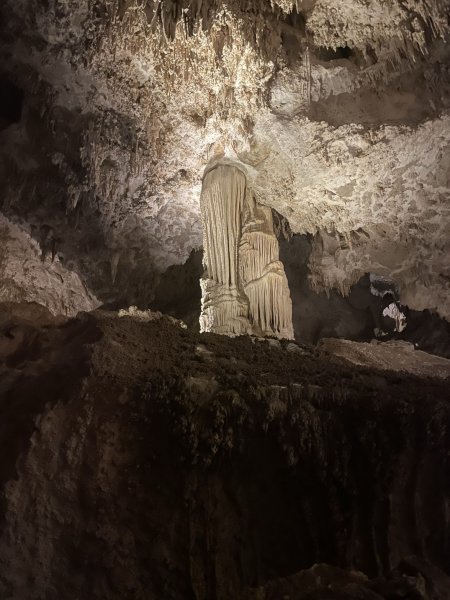
The second part of the day was a guided tour into the King’s Palace portion of the park with Ranger Rick. This area is only open to ranger guided tours because there are no railings to keep morons from destroying the cave. It is a phenomenal area of the caverns to visit, and Ranger Rick knew his stuff including geology, archeology and history of the area. At one point, he did the obligatory turn off of all the lights for a bit so that we could appreciate what it took to explore the caves back in the late 1800’s.

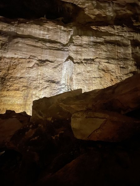
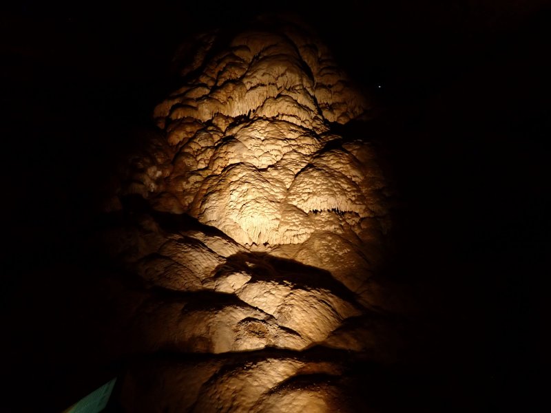
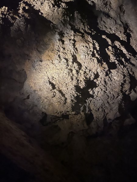
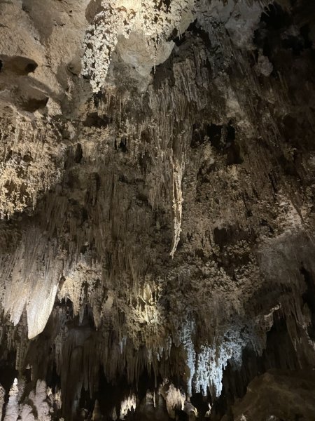
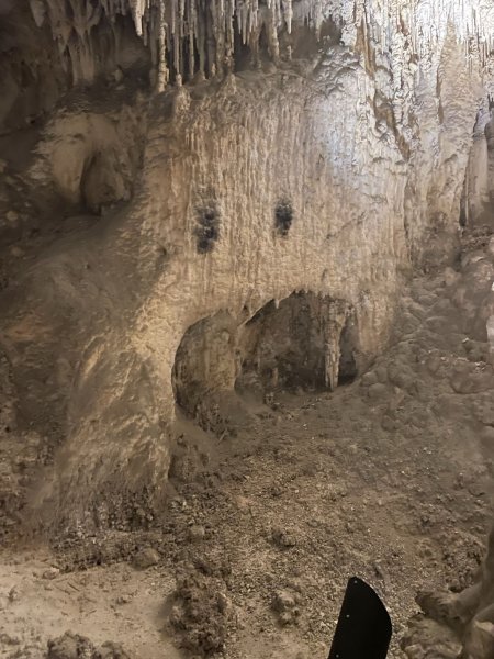
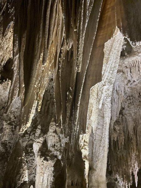
The photos that accompany this post are primarily from Joni’s iPhone. I found that while my camera gave realistic photos with lighting and color, the iPhone did a far better job of making the caverns wild and crazy features and topography visible. Also, apologies for lack of scale in many of the pictures. The dark doesn’t provide much opportunity for distance comparisons. Moreover, the railings and controls to keep Moron Assholes Generally Americans from ruining the cave features does not allow up close warm and fuzzy approaches to the features.

Carlsbad Caverns National Park – April 11-16, 2023 – Day 1 and 2 – The Journey

There is a lot to talk about on this trip and there are a lot of pictures (although only about 1/3 of what we took). We left the OC on April 11 and arrived at Whites City, NM on the afternoon of April 12. There are only a few pictures for this post so don’t pour a cold one just yet.

This was a somewhat more complex adventure than most of our recent trips. There was an airport shuttle (Thanks Kylie!). This was followed by a short flight to Phoenix; an hour+ wait for a flight to Albuquerque; a shorter flight than the wait for the flight (all checked bags arrived!); a car rental encounter at ABQ with a Dollar Rent a Car employee who was not of American descent, obviously hated his job and then got PO’d at me because I could not hear him well enough to understand him. He then proceeded to be utterly disgusted with me since I refused the rip off additional insurance. Through all of that… it was a flippin’ miracle that we got a truly fine, almost brand new out of the box Nisson Murano SUV. A short jaunt to Casa de Pat and a delicious light dinner and early to bed.

Next morning, bright and early, we hit the road for Whites City, NM which is about 7-miles east of Carlsbad Caverns at the bottom of the hill. It was a little over 295 miles and an almost a 5-hour trip with stops. The first 60 miles on I-40 to Clines Corners were scenic…. then we turned south on US-285. While the road is in extremely good condition, I believe that this stretch of road has changed my mind on the most boring stretch of road in America. For entertainment, as we would top a hill and look off in the distance along that straight ribbon of highway, we would note the mileage and guess as to how far ahead we could see the road. There was a 13-mile stretch in there that won on this trip. It continued straight for another several miles, but a hill had blocked our view. We stopped in Roswell, NM (yes that Roswell with little green men) for a quick, nutritious, delicious lunch at a Wendy’s and back on the slog south. The trip south from Roswell was more entertaining as there was oil and gas production to see and a lot of not great looking homesteads with couches in the yard and 10-20 rusted out parts cars and trucks in the yards. BTW, you can get 5-acres of God’s country (only one that wants it) for the staggering amount of $2,500. I suspect that is surface rights only in this part of the world.

UIS-285

Whites City (named for Charlie White – not Jim White [see later posts]) is not a booming metropolis by any stretch of the imagination. It owes its entire existence to people turning to go to Carlsbad Caverns. The park being closed during the covid era pretty well devastated Whites City. It is slowly clawing its way back. There are 3 motels (1 open), one cafe (not often open), an RV park (full), gas station, grocery (see cafe note), souvenir shop and a couple of other empty stores. The gas station is open 24-hours but if pay at the pump is busted, you are SOL. the grocery and the cafe both seem to close at 3:00 PM. We stayed at the motel for the princely sum of $80/night. It was clean, bed was sleepable and an OK base of operations except the refrigerator was not functional and getting ice from the motel office was not always successful. Luckily Joy and Larry had started their adventure for 2023 meeting up with us at Whites City and they provided some ice for chilling the wine. A quick run the 16 miles back north to Carlsbad, NM with Joy and Larry in out trusty Nissan, based on our no-tell motel office ladies recommendation, netted an extremely delicious and a massive Mexican meal, topped off with real-sugar Orange Fanta.

Whites City Strip Mall
Capitalizing on those little green men!

Death Valley National Park – March 23, 2023 — Day 4

This was our last day in the park with only two planned stops; a hike at Golden Canyon to Red Cathedral and stop and pictures from Father Crowley’s overlook. Another sunny Chamber of Commerce Day. Made a couple of short stops driving into the park since lighting on the Furnace Mountains was highlighting the geologic bedding.

Next stop was unplanned as Wylie E. Coyote was strolling on the highway just east of the Inn at Death Valley. Since asking for an autograph seemed a little forward, we just called him over to the window and took his picture. Yellowstone has bears, elk and such. Death Valley has coyotes and birds.

The Golden Canyon hike was very nice … until the very end. Another case of vertical exposure; but only 150 feet or so. My thinking was “same damage in 150 feet as almost 6000 feet from Dante’s View”. There was in the old days, a paved road that went part way up the canyon. You can see remnants of that in some of the pictures below. Golden Canyon is on the east side of the Badwater Basin in the Furnace Creek Formation. The trail turns a bit northward and if you take it past the Red Cathedral goes to at Zabriskie Point and comes back down Gower Gulch back to the basin. Besides the bedding and tortured rocks visible in the canyon, there is a prominent reddish cliff near the Zabriskie Point stop on the trail that was visible in the Day 1 photos on the north side of Zabriskie Point. A great 2.9 mile out and back trail and great hike.

We stopped at the Furnace Creek picnic area for lunch – another very large mixed salad and then proceeded west on Highway 190 to begin our trek back to Cathedral City. It is a long way from Furnace Creek to Highway 395 south. We went around the Panamint Mountains, into Panamint Valley and up onto the Darwin Plateau. During this part of the trip, we crossed 300-million-year-old limestones and siltstones, 200-million-year-old granodiorites and 40-million year-old and younger basalt flows. Lots of tortured rock, great visible faulting and colorful bedding. This took us to the head of Rainbow Canyon and Father Crowley’s outlook with more pictures below. From there the trip continued westward to the Sierra Nevada Mountains and highway 395. We had hoped to see Mt. Whitney, but there were clouds. From there, a relatively fast trip south, dinner at Red Lobster and home in-bed by 9:00 PM.

Great trip!!

Death Valley National Park – March 20-23, 2023 — Day 3

Getting the 300+ photos for day 3 down to a more manageable size took way more work than I had thought it would. Ended up with 177 or so photos, all worthy to hang in the Louvre.

Day 3 started with blue skies and warmer weather. We mapped out the day with a visit to Dante’s View, a lookout on the east side of the Black Mountains; a trip to Badwater, the lowest point in the US; a stop at Natural Bridge trail for a hike; a short stop at Devil’s Golf Course to see another salt pan and a trip around Artists Drive to enjoy the colorful badland topography.

Dante’s view is at an elevation of 5,575 ft ASL on the east side of the park in the Black Mountains. It has a 360-deg view which is beyond spectacular. Death Valley is in the Basin and Range geologic province. This results in the mountain ranges being uplifted with steep mountain fronts on the west side that then slope somewhat more gently downward to the east. Directly west of Dante’s view a little more than 2.3 miles away is Badwater Basin at an elevation of 282 below sea level; an elevation difference of 5,857 feet. Not very far and a lot of tortured rock in-between.

Yellow lines are faults – Distance 2.3 miles – Elevation change 5,857 ft.

I bring this up because as we get older our balance sometimes fades (mine might be more faded than others). There is a trail on the north side of Dante’s View overlook that follows the side of the cliff up another 300+/- feet with a lot of vertical exposure on west side of the itty-bitty, granitic Grus trail that had a bit of snow on it. That bit of exposure pointed out to me a relationship between age, balance and bravado. As on goes up the other two go down …. maybe exponentially. Anyway, we made it up and made it down so there is that.

Second stop of the day after a bit of a drive was the Badwater Basin. There are few places to eat in Death Valley and the pricing is somewhat princely, so we had packed a cooler full of lunch goodies for the trip and we performed ice-maintenance each night to keep it all cool. Before exploring the salt pan, we had a bit of lunch. While sitting there with our geology road trip book and enjoying mixed salads, we looked up and someone had climbed up the cliff on the east side of the road and placed a sea level sign (somewhere in the photos below), before exploring the salt pan.

Next stop was Natural Bridge trail, a short 1.4 mile round trip hike including a 35-foot-tall natural bridge in the alluvial valley deposits that was entirely eroded out by running water in the canyon. In some of the pictures, you can see that on the north side (left going in, right coming out) of the bridge there is a channel cut where the water would flow around dam that blocked the flow, was eventually eroded out and then became a photo-op as a natrual bridge.

After leaving Natural Bridge trailhead, we continued north and then detoured west back out onto the salt pan to see the Devil’s Golf Course. This area has been shaped by wind and water into a huge area of sharp pieces of broken and jagged salt pan. No hiking on that!

Final stop for the day was a drive along the one-way road, Artists Drive, which is predominately in an area of young, multi-colored volcanic rocks (appropriately called the Artists Drive formation) along the east side of the valley. Very windy but very scenic. Made a stop at an overlook called Artists Palette which was pretty spectacular from the standpoint of colored rock outcrops. The green colors are from a mixture of iron and chlorite in the rock, not copper. Sort of an end of the day stop so we broke out some adult beverages and just sat and admired the view.

Death Valley National Park – March 20-23, 2023 — Day 2

A little bit of geography here. Death Valley National Park is the largest national park in the continental United States encompassing over 3,422,000 acres of arid desert east of the Sierra Nevada Mountains. Within the park, the elevation change is over 11,300 feet ranging from 11,049 feet ASL at Telescope Peak to -282 ft ASL at Badwater Basin. When I talk about the “Basins” I am referring to the low (extremely low) valleys located more or less on the eastern side of the park between north-south trending mountain ranges on either side. The Panamint and Cottnwood Mountains and Last Chance Range roughly trend south to north through the middle of the park, with Mormon Point Basin, Badwater Basin, Cottonball Basin and Mesquite Flat Basin immediately to the east of these high areas. From south to north, the Black, Funeral and Grapevine Mountains are immediately east of the Basins.

Average rainfall in Death Valley is on the order of 2-inches/year. We were there for this years event. It included 20 knot winds with gusts to 30, temperature of 42 deg F with a wind chill of 37 deg F, sleet at lower elevations and snow at higher elevations.

Still, we soldiered on. By God, this was vacation!! We started the day with a drive around 20 Mule Team Canyon which is a 2 WD dirt road between the park boundary and Zabriskie Point. Lots of old mine workings and tails. The entire area is in the Furnace Creek Formation which is a >5,000 ft thick, geologically young, lake (5 – 6 million years ag0 [mya]) deposit which is the primary source of the borate (borax) in this area. The Furnace creek is cut by younger basalts and has weathered out to the colorful badlands topography that are found in this part of the park and show up on the picture below.

The second stop of the day was after a 66-mile, rainy drive to the Ubehebe Crater located more to the north side of the park. This was what sailors call our victory-at-sea leg for the day. A combination of rain and sleet was falling, mostly horizontally in the 30 mile per hour, 42 deg F (37 deg F. wind chill) winds, as we made our way north along the west side of the Funeral Mountains, Kit Fox Hills and Grapevine Mountains all located on the eastern side of the Basins. We ended up dodging and coaxing the small but powerful and potentially floatation friendly CMAX across sheet flow coming down off of the hills across the alluvial fans and road and then continuing down into the Basin. Ubehebe Crater is one of 7 relatively (potentially extremely) young volcanic craters formed from 800 to 7,000 years ago when rising magma encountered ground water and flashed into steam in the subsurface increasing pressures to the point of an explosion. Only minimal lava is found in the area in Little Ubehebe Crater. What is left for observation is up to 150 feet of black cinder and ash deposits on the ground locally and an approximately 700 foot deep 0.5-mile-wide hole in the ground with several smaller craters ringing the main crater. Lunch in the car at the crater rim watching underdressed tourists shivering while they were hugging themselves and walking around with their heads bowed.

Third stop was a quick swing down to the location of the original Stovepipe Well 36 miles south along the wet and muddy highway. It was named by early travelers after marking the location toward the eastern side of the Basins with a stovepipe so that folks traveling after them could find it if and when it got buried with blowing sand.

From the original Stovepipe well, we headed 9 miles west across the Basins (lots of long, straight stretches of highway in this part of the world) making a stop at the Mesquite Flat Dunes for some pictures and a short hike out onto the near dunes.

We then headed for Mosaic Canyon going through the settlement/resort Stovepipe Wells and noting the location of an architecturally and location appropriate saloon. Mosaic Canyon is located on the north flank of Tucki Mountain in the northern Panamint Mountain Range on the west side of the Basins. We made our way up to the parking area and hiked into the canyon. What a difference geologically between the east and west highland areas of the park. Mosaic Canyon is predominately cut into the Noonday Formation which is a 600+ million-year-old sequence of carbonates including dolostone, limestone and marbles which originated on the sea floor in the deep dark past before the evolutionary explosion in the Cambrian Period when our ancestors slithered out of the oceans. The younger (but not by much) Johnnie Formation lies above the Noonday and it is predominately a purplish mudstone. There are young gravels, created and deposited in the high energy streamflow environment at the mouth of the canyon. Finally, the photos below show the rocks that the canyon is named for. Areas of large angular pebbles and cobbles are seen cemented into areas of the canyon.

After an exhilarating and slightly damp Mosaic Canyon hike, a stop at the saloon for beer/wine and then as the clouds cleared out and sun began poking through before a spectacular Death Valley Sunset, we di a longish drive back to the Longstreet Inn taking classic desert pictures on the way.

Day 2 was an adventure! There are a lot of pictures in this set!

Death Valley National Park March 20 – 23, 2023 — Day 1

Started out Spring 2023 with a four-day trip in the small, low clearance (as we found out) but powerful Ford CMAX to Death Valley NP (DV). We took a bit of a secondary route, leaving from Cathedral City and for the most part, two lane roads north. There was a short stint east on I-15 from Barstow to Baker so that we could have lunch at the Mad Greek. A very scenic 283 +/- mile trip past Eagle Mountain and ending up at Zabriskie Point in DV around 2:00 PM.

For those of you who remember the early ’70’s, Zabriskie Point was a fairly unimpressive movie based on plot and acting, with era appropriate angst, free living and free loving (in the dirt at Zabriskie Point as I recall) but with some great music by early Pink Floyd and Grateful Dead. In truth, Zabriskie Point was named in the early 1900’s after a manager of the largest borax mining operations in area. Again, for the older crowd, you may remember a TV show from the later ’50s and early ’60s called Death Valley Days which was a vignette based western sponsored by, you guessed it, US Borax. As I recall, one of the narrators that passed through the show was Ronald Regan.

Zabriskie Point, which is still from 700 to 1000 feet above the valley floor, ended up being a prelude to the next three days of “oh wows!” and “look at that!” scenery and geologic features. The Point is on the east side of the park in the Furnace Creek Formation which provides the badlands topography that you see in some of the pictures below (slow picture day … but the pace picked up to a staggering 250+ photos a day).

Joni reserved a hotel for us about 40 miles from the DV visitor center at the Longstreet Inn, Casino, RV-Park (gas station, petting zoo, pond with ducks and geese and the requisite casino wedding chapel) for half of the price of the cheapest (other than camping) accommodations in the park which range from $200+ to $600+ a night. Our room was huge, clean, comfortable and had a fireplace and an outside patio overlooking the pond. In addition, the meals in the restaurant were tasty and they offered voluminous, low-cost comfort food. The ambiance was eclectic including a bar cat that sat on the bar. Better yet, it was on the Nevada side of the state line, so gas was $1.75/gallon cheaper than in the park which had a monopoly on gasoline on the California side of the border.

Glow in the Dark – The Living Desert – March 16, 2023

Not a typical hike but still worth 4,400 steps. The Living Desert Zoo and Gardens in Palm Desert is one of our favorite goto spots for relaxing and enjoyable strolling among the animals and desert fauna. This trip was a members only preview event for their annual glow in the dark exhibit. Sunset and after dark are our favorite times to visit since the views are very nice and there are more animals out and about since some of them are nocturnal. We saw the cheetahs this trip which was a first since they are very nocturnal.

It is all very civilized with specialty cocktails and snacks and event meal items. Pricing had gone up significantly since the Christmas event, so we limited our food purchases and visited one of our favorite open-late Palm Desert restaurants after the event.

Ladder Canyon – February 19, 2023

We continue to be drawn to Mecca, California for the scenery and geology. This trip was something of a surprise due to the number of cars, campers and people that were also enjoying the area. Apparently, a Sunday in February with no football on TV is a huge draw. Kiara and Blake joined us for this trip and Blake drove us in the truck. If we had taken the CMAX, it would still be out there high centered on the road somewhere.

We took the Ladder Canyon trail on a whim as we were heading up the Painted Canyon Trail. Fantastic scenery and geology. We did not complete the entire trail, opting for about a 3.2 mile out and back rather than the 5-mile loop. We did about 600 feet of elevation change up ladders and through slot canyons until we arrived just below the ridge line. Not sure if it was the exertion or the uncomfortable stress from wobbly ladders with less than easy steps off the ladders onto the canyon base that required an inhaler hit on my part. In retrospect, I think it was the healthy respect for the 20-foot ladder fall that caused some respiratory stress.

Finished the hike with a picnic including Coachella Brewing Company CDMX beer and selection of healthy and filling snacks.

Kicked Our Butts – Murray Canyon to Seven Falls February 1, 2023

There are four canyons included in the Indian Canyon Park. We had hiked three and decided to get the fourth. Murray Canyon is the longest hike (3.9 miles) that we have done. It is an out and back trail following Murray Creek with about 670 feet of elevation gain. Turns out that most of that elevation gain is in the last 0.2 miles, mostly up a rock face cliff. However, it is like the other three trails, a beautiful hike, with great geology and several incredible palm oases along the creek. The oases have California fan palms ( Washingtonia filifera) which are actually the only palm that is indigenous to California.

The creek was running full and fast. The trail included crossing the creek eight times, three of those on logs across and above the creek, the other five on rocks. The logs were narrow and at my age they looked to be 30 feet above the creek. Joni reported that they were only one to something less than three feet above the creek. Somewhat stressful, but negotiable for me… Joni had fun with them.

Rocks look safer!

The real issue became scaling the cliff at the first falls. Our knees, legs, backs and lungs (mine) were not really up to the task, so we did not complete the trail. It was a little embarrassing as we watched three kids about 12 years old, one barefoot, almost run up the trail in front of us…and then pass us at a kid run on the way back.

Age-Appropriate Heroic Adventure — Joshua Tree Camping Trip January 23-26, 2023

Heroic adventures are the adventures that you look back on and think “Man, glad I made it through that one… that was awesome!”. Example: Snowshoeing up the Cache La Poudre River in Colorado in March when you are 20 or 21, it’s snowing and you’re sleeping under a tarp in a depression dug in the snow and drinking cowboy coffee in the morning. Age-appropriate heroic adventures are renting an RV, dry camping in very sparsely populated national park campground at Joshua Tree (here is the heroic part…) winds blowing out of the north at up to 30 knots, gusting to 35 knots, air temperature at night hovering in the mid-30’s, lots of snow visible on San Gorgonio and San Jacinto Mountauins and the RV house battery powering the fan on the propane heater indicating that it had been a long day and it was taking the rest of the night off. To add to the excitement, the RV was a small class B coach on a Dodge Ram van chassis so there was only a 4-gallon cassette toilet on board, and we used the NP pit toilets for the majority of our waste disposal activities. We were not sure if the lack of odor in the facility was due to incredible engineering or if everything down in the hole was frozen. I believe it was engineering since the venting on that hole was phenomenal, increasing in intensity with each wind gust. It was the opposite of the nice warm Japanese bidet experience. However, as in real life heroic adventures, everything looked much better each morning thanks to our Keurig coffee maker brew with Kahlua and or Baileys to help warm up the morning.

But I digress. We spent three nights camping at Jumbo Rocks in Joshua Tree in a largely empty primitive campground surrounded by monzogranite everywhere that we looked. In case it is not obvious yet…. I am in awe of this place. Almost as much as Mesa Verde. JT is a geologist Mecca and now, finally after almost 48 years, I do know the answer to the question of why a granite is a granite.

I had initially started the planning on this adventure thinking that we could sleep in a tent, or alternatively (after a very short discussion with my better half), I could sleep in a tent and Joni could sleep in an RV. Luckily, high wind warnings and the forecast of butt numbing cold gave me a gracious way out of that heroic foolishness and the tent stayed home.

We did get a couple of hikes in during the trip so there are pictures below. Notice that the sun was out all day, and the stars (including the Milky Way and every airplane flying into the LA Basin) were all visible at night. The downside was the wind, which did moderate on Wednesday during the day but came back with a gusty vengeance around 3:00 AM on Thursday morning.

I did cut way back on the number of pictures include (no… really, I did!). As I told Joni, you can only take so many pictures of really odd-looking granite.