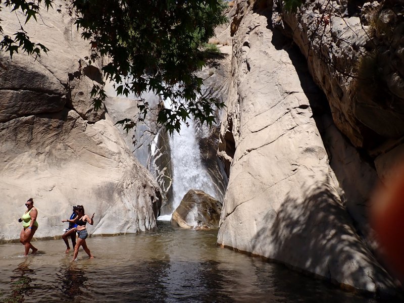
A favorite short hike of 1.9 miles with 384 feet of elevation gain on the south side of Palm Springs. Lynn Acosta was visiting for a few days with Izzy and Rosie and this is one of those must-see attractions for visitors to the area. It is a hike with several limitations (no dogs, high entrance fee) but offers a relatively easy hike with great scenery and geology and of course the falls at the loop turn around, especially with high volume, late spring/early summer runoff in Tahquitz Creek. The day was surprisingly temperate for this time of year with a light breeze, which was great because there is scant shade along the trail until you get to the falls.
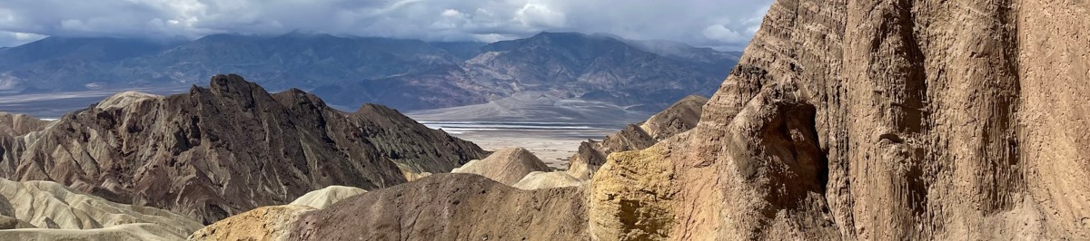
The geology here is dominated by the easterly dipping Palm Springs Complex metamorphic rocks as you enter the canyon from the visitor center. These are a series of metamorphic rocks (generally a gneiss) of somewhat uncertain age but generally agreed to have formed from 600 to 250 mya from sedimentary rocks deposited in an offshore environment. We know that they are older than the Peninsular Range Batholith which was emplaced in two episodes: the western side from 140 to 104 mya, and the eastern side from 105 to 80 mya. In the Palm Springs area this portion of the mountain range is known as the San Jacinto mountains. These are west of Palm Springs and are generally made up of a granodiorite and quartz diorite core. Therefore, similar to the Joshua Tree geology, the big glob of magma goo that formed the batholith intruded into the metamorphic rocks far beneath the surface, hung out there for a significant amount of time and eventually were uplifted, eroded, and uplifted some more.
The San Jacinto mountains, as we see them, were formed relatively recently with uplift along three faults forming a triangle. The triangle extends on the north side (South Pass Fault) located south of I-10, the east side (Palm Canyon Fault) which is the mountain front seen from the Coachella Valley and the west side (San Jacinto Fault) that is west of the highlands near Idyllwild, Ca. Mount San Jacinto tops out at 10, 813 feet above sea level with over 10,300 +/- feet of relief in the seven miles from the peak to the floor of the Coachella Valley forming one of the greatest mountain front scarps in the world.
From the pictures, you can see at the entrance to the Tahquitz Canyon, the Palm Canyon Complex formation which is a deep reddish brown due to desert varnish. Here is the result of my foray into AI internet searches. Desert varnish is an orangish yellow to black coating found on exposed rock surfaces in arid environments. It is composed of clay minerals, oxides and hydroxides of manganese and/or iron, as well as other particles such as sand grains and trace elements. It is formed by bacteria that oxidize manganese and iron and cement them onto the rock. The color of the varnish depends on the relative amounts of manganese and iron in it. Desert varnish can take thousands of years to form and can be eroded by acidic conditions, lichens, or human vandalism. Back to the trail. From the pictures you can see that the falls flow over the granodiorite that forms the core of the San Jacinto Mountains.


